Who Was WP Franklin?

Ellie Bunting • July 3, 2021

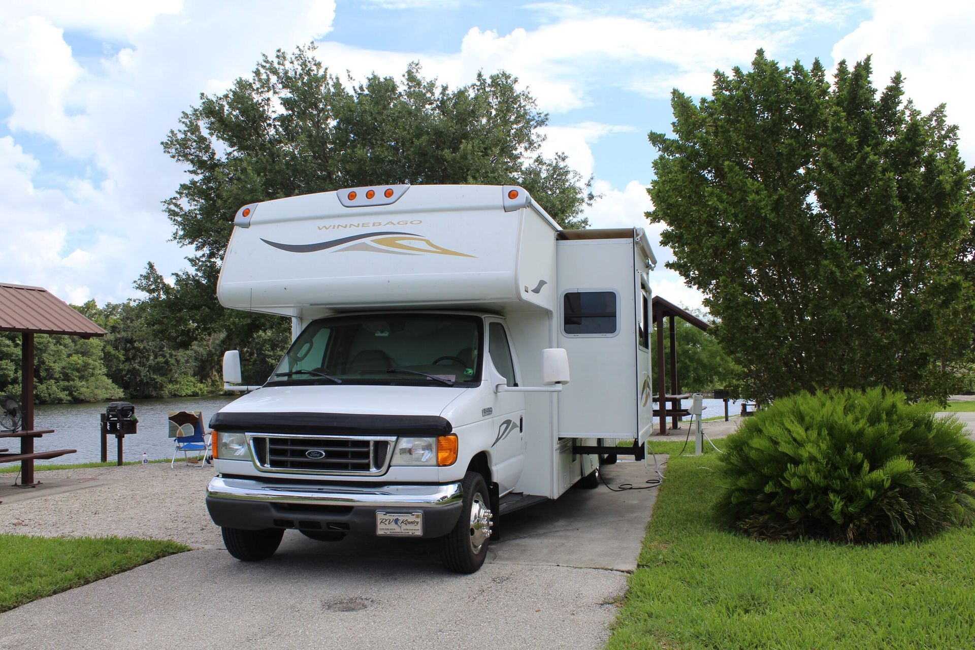
This is our campsite at the WP Franklin Campground.


Recently, my husband and I took our motor home to the WP Franklin campground. Located in Olga, the campground has 29 RV sites and 8 boat sites with 50 amp electric and water hookups. There is a boat ramp and a fishing pier which makes access to the river easy if you bring a boat.

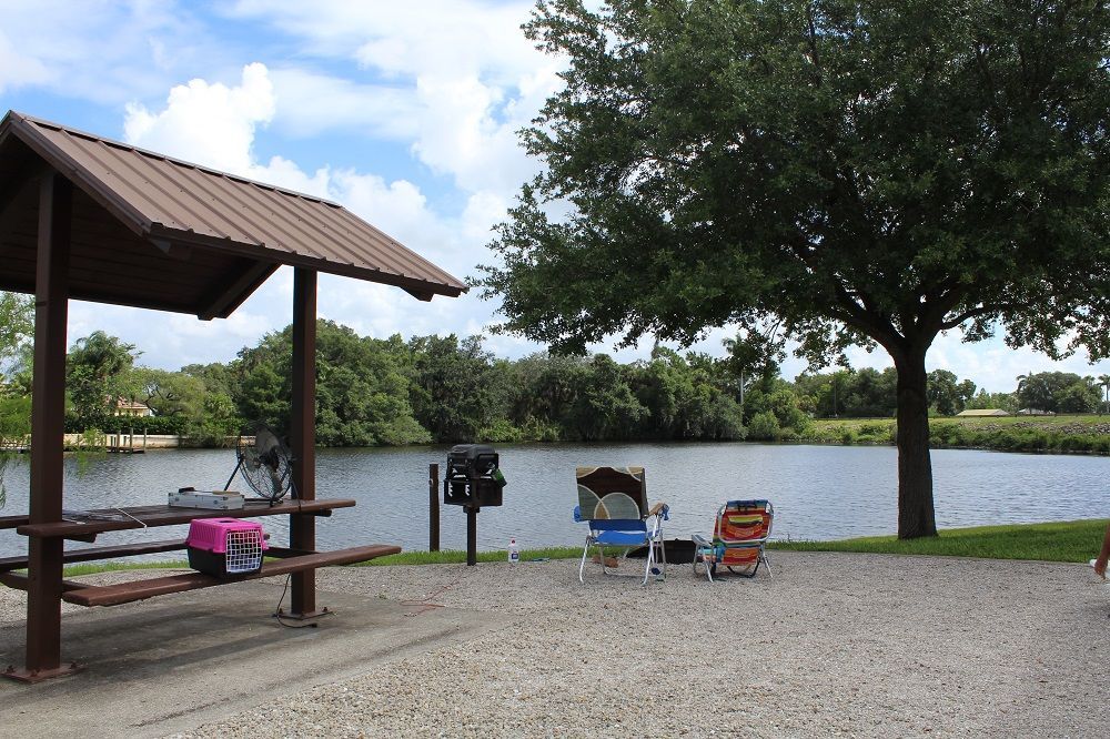
The view was nice and we could tie the boat up to the post.


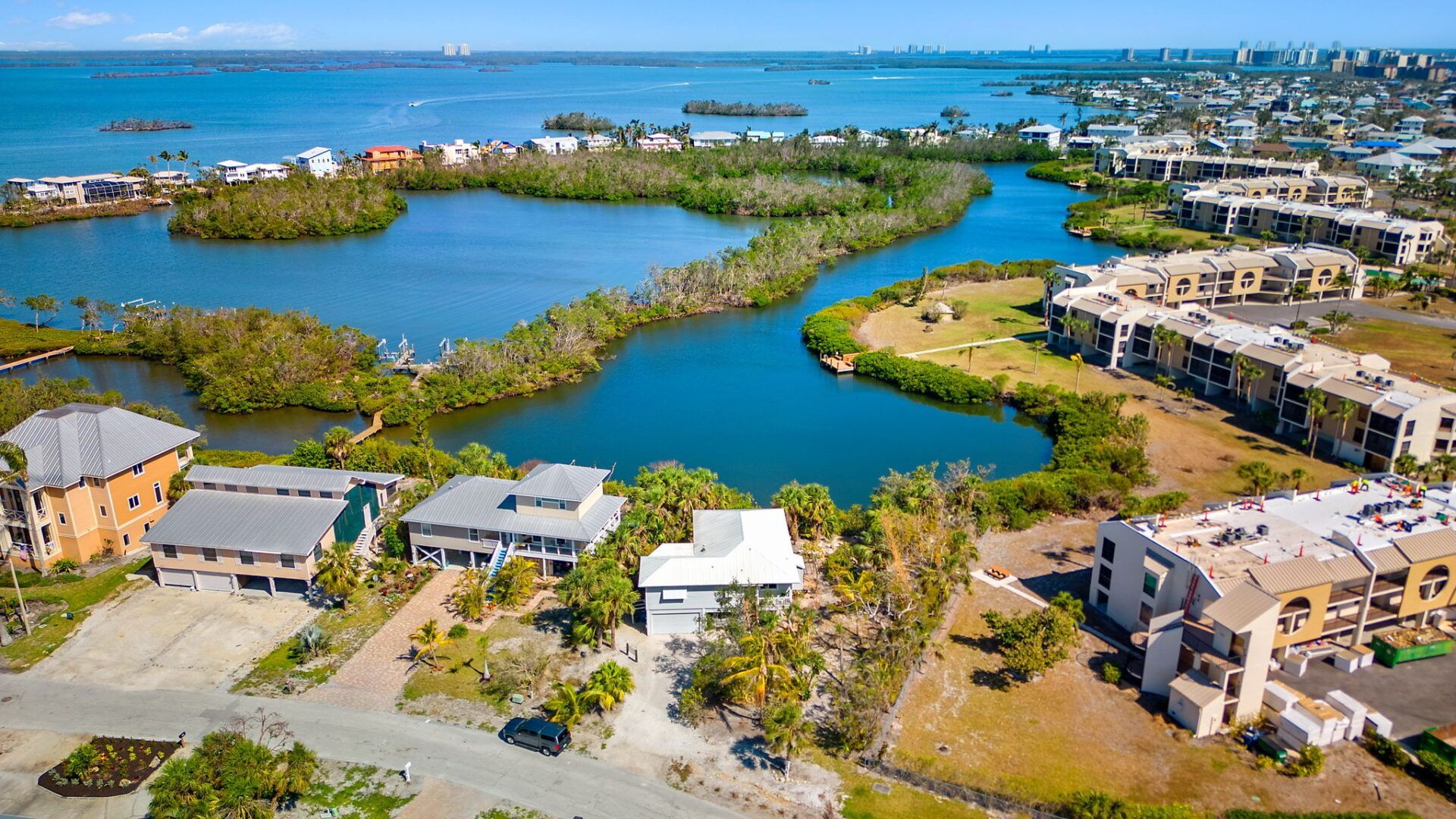
The campground is surrounded by the Caloosahatchee River with most sites located directly on the water. The water on the east side of the locks is fresh, while the water on the west side is salt. Fishing for both is a popular pastime with a nice fishing pier going out by the locks.


We arrived on a Friday evening after the office had closed. We were late because when we plugged WP Franklin Locks Recreation area into the GPS we were directed to the Recreation Area on the south side of the river. This is a day use only area which is directly across from the camping area.


Once we figured out we were in the wrong place, we punched in the correct address for the campground, and about 20 minutes later, we were at the correct location. 

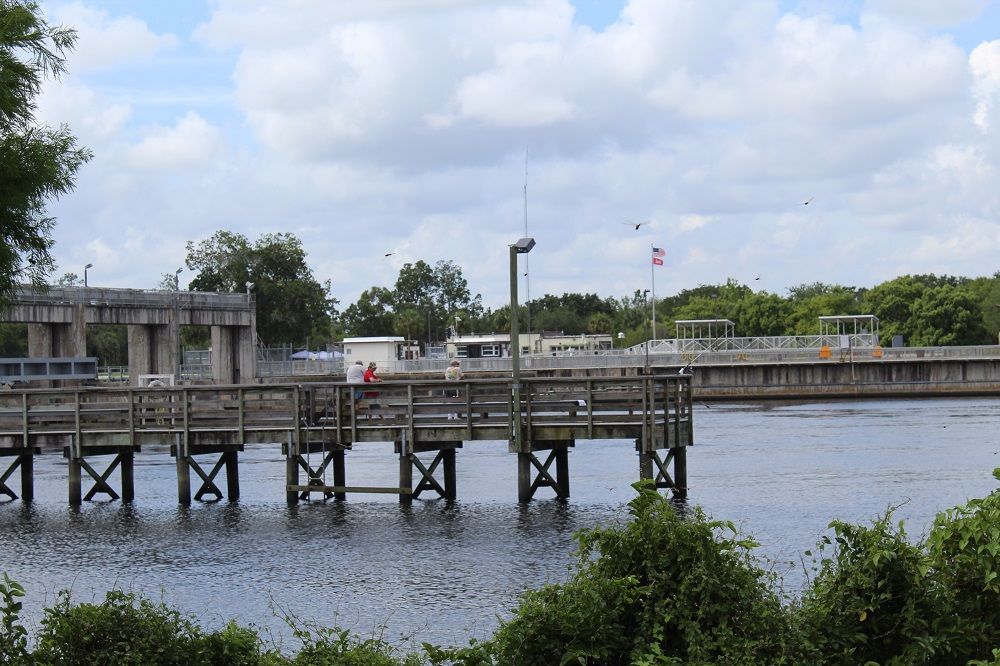
The fishing pier at the locks was a popular place to watch the boats and catch a few.


When we first arrived, we had no idea where we were supposed to go. We couldn’t find any camp hosts to help us out, so we just drove aimlessly around the park a couple of times until we found the volunteers on duty in the evening. We looked over our reservation receipt many times hoping to locate a site number on the reservation.  We later found out that the site number is the first number on the confirmation email. This would have been nice to know starting out.


The camp hosts, however, were most helpful. They directed us to our site and showed us where we could park the boat and the boat trailer. Our site was on a waterway that led out to the saltwater side of the river. There was a post where we could tie the boat once we put it in the water and crossed the locks.


The park itself is one of the most nicest that we have ever camped in, and we have been to quite a few RV parks in the 40 plus years that we have been RVing. We spent the day exploring the east side of the river taking a boat ride up past the Alva bridge.


WP Franklin

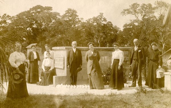
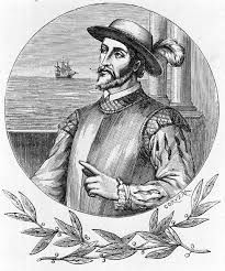
Naturally, my curiosity got the better of me, and I wanted to know more about WP Franklin. Who was he and why is the lock/dam named after him? It didn’t take long to learn more about this man who was a major player in Fort Myers history.


Walter Prospect Franklin was born in South Boston, Virginia and graduated from Ebon College in North Carolina. Franklin came to Florida in 1900 and worked in the sawmill industry. He came to Fort Myer for the first time in 1904 when he was selling sawmill parts. Nine years later he returned to run Franklin Hardware Company in Fort Myers. A civic- minded individual, Franklin became president of the organization known as the “Gulf, Okeechobee, and Atlantic Waterway Association.” The purpose of this group was to lobby for federal funding for flood control in the Lake O watershed.
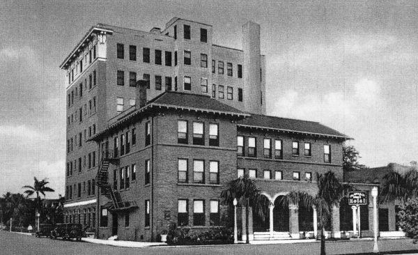
Franklin Arms Hotel


In 1918, Franklin bought The Hill House from Flossy Hill in downtown Fort Myers. It became the Franklin Arms Hotel. He expanded it five years later with an 84-room addition which was eight stories high becoming the city’s first high rise. Franklin was mayor of Fort Myers in 1917 and 1918, and, according to FM historian Karl Grismer, he was, “a leading factor in the completion of the cross-state waterway.” In his History of Fort Myers, Grismer wrote it was “largely through Franklin’s efforts that the necessary surveys were made and the project started in 1932.” The Okeechobee Waterway officially opened in 1937 connecting Fort Myers to Stuart.


After the 1926 and 1928 hurricanes, Franklin went to Washington to lobby for 18 million in funds to help control the floods that killed thousands of people during the 1928 storm. Franklin managed to get money and support to build the Hoover Dike around Lake 0 in 1930.


Lake O Waterway

After learning all of this about Franklin, I felt obligated to learn more about the Lake O waterway that he was so instrumental in promoting. The Lake O waterway runs 154 miles from the Atlanta Ocean in Stuart to the Gulf of Mexico at Punta Rassa.  The waterway is bordered on the west by Caloosahatchee River and on the east by the St. Lucie Canal.


There are five navigation locks and dams along the waterway. The Franklin locks was designed to control the flow of water from Lake O to the river.  Tides and releases of water from the lake cause the salinity levels to change in the estuary and this affects the health of animals and plants who depend on this environment for survival.


Now that I knew about waterway and the purpose of the locks, I ended up going down a rabbit hole researching the history of the river.


The River Runs Through It

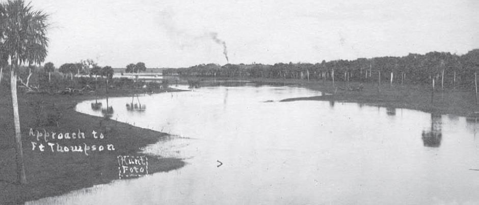
Many years ago, before man began interfering in our natural waterways, the Caloosahatchee River originated in a basin located near Fort Thompson, two miles from LaBelle. This was known as the Lake Flint basin. 


The river contained 102 bends in the 64 miles between Beautiful Island and Lake O which made navigation difficult. The water would rise 4 to 10 feet above the river at certain times of the year creating a .09 mile long rapids that flowed over the banks of the river creating marshes and connecting a series of lakes. During the dry season, the riverbed would dry up and during the wet season, the water level would rise up to 17 feet above the bank of the river.


In the 1800s officials realized that developing this part of Florida would be difficult unless they could find a way to control the flooding. Hamilton Disston, in 1887, brought in dredges to straighten four of the worst bends in the river west of Fort Thompson.  If the river were straightened, barges could travel upstream. They built dams every few miles in hopes of controlling the flow of water. The intent of this dredging was not really to help navigation. Rather, it was designed to drain the valley and confine the river to its banks.

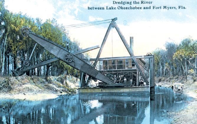
Eventually the dredging would open up a 300 mile water route from the gulf to central Florida by way of the Caloosahatchee and Kississimmee Rivers. Disstin never finished the project and the dredged channel between Fort Thompson and Lake O was not maintained, so it did not take long for shoals to appear. In addition, during the wet season, water would rush unrestricted down the channel causing flooding.


In 1913, drainage in Central Florida lowered the water in Lake O so much that navigation was impossible.  By 1914, in LaBelle, the water level in the river was only 1.5 feet. At this time, the state dredged a channel from Lake O to LaBelle that was five feet deep and 40 feet wide.

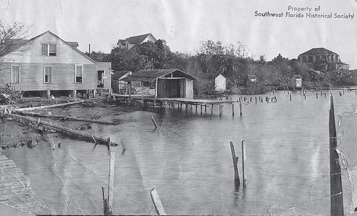
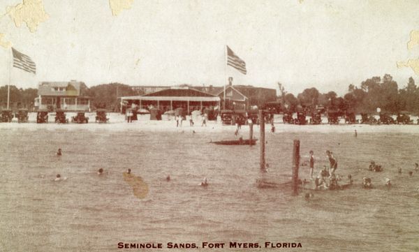
This is what the river looked like back in the 1800s.


Floods in 1922, 1923, 1926, 1928 caused Feds to authorize the Army Corp of Engineers to survey the area a improve flood protection and navigation.


In 1930, river dredging continued along with the building of drainage canals, locks, and pump stations. In this way, the river was changed from a naturally meandering waterway to a vertical, flood-controlled waterway.

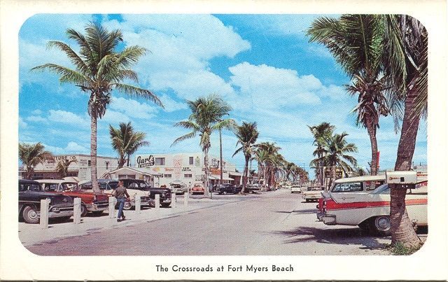
Before all of the dredging and straightening, the river looked like this.


In the 1950s the channel was 8 feet deep and 250 feet wide. A new lock and dam was constructed at Olga in 1962 and dedicated to WP Franklin in 1969. Today, the locks artificially set the eastern limits of the gulf’s tidal influence on the esturary. Lake Flirt is gone.


WP Franklin lock is the western line of protection limiting storm surge from the gulf and salt water intrusion into the river’s estuary.

By Ellie Bunting December 27, 2024
In January, the speaker for Estero Island Historic Society’s public meeting will be Martha Bireda, director of the Blanchard House Museum of African American History and Culture of Charlotte County. Ms. Bireda is the great-granddaughter of Queen Evans Andrews, a pioneer who came to Punta Gorda in 1897 from Charleston, South Carolina. She will share stories of the Gullah culture and of her visits with the Gullah people who live on James and Johns Islands. Having just visited the Georgia and South Carolina Coasts, I thought this might be a good time to do a bit of research into the Gullah culture in anticipation of our January meeting.
By Ellie Bunting October 8, 2024
Repairing the St. Pete pier after the storm. Florida Archives. As we prepare to run from another hurricane, it might be helpful to reflect upon the 1921 “Tampa Bay” hurricane which hit the Tarpon Springs/Tampa area on October 28, 1921 This was the first major storm to hit the Tampa area since the “Great Gale” of 1848. We can draw a few parallels between this hurricane and what we are now facing with Milton. In 1921, the weather forecasting was not what it is today; rather, the forecast was based on observation sites which reported breezy and cloudy conditions around a low pressure system that was organizing off the coast of Honduras on October 20 and 21. By October 22 and 23, the area of low pressure began to intensify. Winds reached tropical storm force at the observation sites. The sites reported thunderstorms and cloudiness across the Caribbean. 
By Ellie Bunting September 1, 2024
Searching for survivors on Upper Matecumbe Key after the storm. Photo Credit: Creative Commons In the late summer of 1935, the citizens of the Florida Keys were in the depths of the Great Depression. Key West, once a prosperous port city, had declared bankruptcy. Residents were struggling to live on an average monthly income of $7. The city needed a plan to survive so it was decided to rehab the old buildings and re-create Key West as a tourist destination. The government saw this as a way to help the jobless World War I veterans who had been affected by the economic downturn. The vets would be paid $30 a month plus free room and board to come to the Keys and build the bridges and roads that would be needed to support the Key West plan. The men were housed in flimsy shacks built on the shoreline. Residents of the Keys warned that this housing would never survive a hurricane, but their warnings were not heeded. The government plan in case of a storm was to send a special train from Miami to evacuate the vets if a storm approached. Like many plans, this one was not thought through very well. The railroad officials insisted that they would need several hours of lead time to get a train ready and on its way to the Keys.  It was in late August 1935 that a tropical wave came off the coast of Africa heading across the Atlantic towards the Caribbean. At this time, predicting storms was not a science. With no satellite images or hurricane hunter planes, meteorologists were pretty much shooting in the dark with only a newly developed radar to help them predict when or where a storm would hit.
By Ellie Bunting September 1, 2024
Who was Jack DeLysle? I had been reading about him in different articles as I was doing research on the early days on the island. I had come up empty except for one cryptic note I found that he “left the island under mysterious circumstances.” Yesterday, I was going through copies of the Sand Paper that were donated to the historic society and found an article by Jean Matthews that was about Jack DeLysle. This is what I learned about the mystery man who played a pivotal role in the early development of the island. Jack and his brother, John, first appeared in Southwest Florida after their ship ran aground at the moth of Gordon’s Pass. When Sheriff Frank Tippins arrived to investigate the incident, he found 320 boxes of “Soap” that turned out to be whiskey. The brothers had apparently picked up the moonshine in Alabama and sailed to Tampa, then Key West, and finally to Cuba. When they returned to Florida, they were caught in a storm and the ship was wrecked. “Captain” Jack DeLysle claimed he was in the British Army; however, he and John were arrested and turned over to the Feds. Both men were found innocent by a jury in Tampa and Jack returned to Fort Myers where he was into many different endeavors. Although he wrote poetry that he published in the local paper, DeLysle is best known for his efforts to raise money to build a bridge to Fort Myers Beach. He joined the Crescent Bridge Road Company where he met E.E. Damkohler. Damkohler was trying to raise money to build a road from Miner’s Corner to the Island. DeLysle saw potential in Crescent Beach ( old name for Fort Myers Beach)being developed into a tourist mecca like Miami Beach. He purchased property in Case Subdivision and built the Seminole Sands Casino. DeLysle’s casino had a game room with tables and slot machines, changing rooms, a dance pavilion, and a restaurant.
By Ellie Bunting July 3, 2024
Did Al Capone spend a week on Fort Myers Beach back in 1929 or 1930? According to Jean Matthew, Capone and some of his lawyers may have stayed at the home of Dr. Baker Whisnant in Seminole Park. The group consisted of two attorneys and their families, including their children, and of course, Mrs. and Mrs. Capone. Matthews states that the two lawyers who were with Capone rented a beach cottage at the same time they rented the home in Fort Myers. Rumors began spreading around town that Capone and his gang had been seen hanging round in downtown Fort Myers. The cook who worked at the Seminole Park house while the gang was staying there stated that every morning a strange man would appear and eat breakfast at the house, arriving from the beach. Was this mysterious stranger really the infamous Al Capone? The cook’s description of the man sounded like Capone who also had a deep scar on the left side of his face. The strange man never went out during the day. He would stay home and play with the children until evening when he would leave. Other people in town also recall this stranger who may have been the famous gangster. A young gas station attendant who was working at the Standard Oil station on McGregor waited on the stranger. When he was caught staring at the gangster, Capone is reported to have told him, “You know who I am, but kept it under your hat.” Mrs. Whisnant, the owner of the Seminole Park home, said that the group acted strange from the beginning. They didn’t register at a hotel. They immediately sought out the realtor who was in charge of the rental and were brought to the home immediately. They took only a brief time to look over the house before asking to move in in immediately. They didn’t want a phone. They asked about the mail but insisted that their business was all transacted by telegraph. When the group left, and the owner was cleaning up her house, she found many cases of empty liquor bottles. The residents of Seminole Park told her that the renters were not very friendly and stayed to themselves.  After reading this in the Sandpaper, I decided to do a bit more research to get to the truth about Al Capone’s visit to Southwest Florida.
By Ellie Bunting June 14, 2024
The Tip Top was a popular hangout for teens back in the day.
By Ellie Bunting June 3, 2024
As we are all still recovering from Hurricane Ian, the news from NOAA that was released this week is a bit intimidating. Forecasters estimate 17- 25 named storms this season with 8-13 reaching hurricane strength. Of these, forecasters predict that 4-7 would be considered “major.” This is not great news, and it gets worse. Florida has a 96% chance of being impacted by one or more of these named storms. If we look at only hurricanes, the probability of a hurricane hitting the sunshine state drops to 75%. This drops even more to 44% when we look only at a ‘major’ hurricane hitting our state.
By Ellie Bunting May 7, 2024
While doing research for Lost Icons, I came across a quote in the News-Press that I have cited several times in other articles and presentations. Written in the late 1970s, this quote seems to bring the past and the future together quite nicely: “Nobody really wants to stop progress, but there is an increasing awareness that the island is in danger of becoming a polluted paradise.” Over fifty years ago, the paper stated that Fort Myers Beach was at a crossroads. The 70s were a time of rapid, uncontrolled development with over 68 condos being developed in a single decade. This led residents to vote to incorporate the town so we could control our own destiny and stop the over-development of our island. The newly born town elected its first town council who worked very hard to create a comp plan that would guide our development and preserve our island lifestyle. This plan was completed in 1995 and had served us well until Hurricane Ian damaged every building on the island. Now that we are in the rebuilding mode, we are once again at a crossroads: Do we stick to the comp plan and turn down the developers who want to build higher and bigger? So far, the council has been carefully considering all arguments and is making logical decisions trying to keep as close to the comp plan as possible. The council and residents need to tread carefully to make sure, in our efforts to build back, we spend time anticipating the unintended consequences of building back bigger. One very good example of this is the recent attempt of two legislators to take back 225 acres that are part of the Estero Bay Aquatic Preserve. (More on this in another post). This was not the first time our beautiful back bay was threatened. Let’s go back to the 1960s when a group of concerned residents decided to take action to preserve the beauty of our back bay. Back to the Future
By Ellie Bunting April 27, 2024
Is It Getting More Affordable to Buy a Home? Over the past year or so, a lot of people have been talking about how tough it is to buy a home . And while there’s no arguing affordability is still tight, there are signs it’s starting to get a bit better and may improve even more throughout the year. Elijah de la Campa, Senior Economist at Redfin, says : “ We’re slowly climbing our way out of an affordability hole, but we have a long way to go. Rates have come down from their peak and are expected to fall again by the end of the year, which should make homebuying a little more affordable and incentivize buyers to come off the sidelines.” Here’s a look at the latest data for the three biggest factors that affect home affordability: mortgage rates , home prices , and wages. 1. Mortgage Rates Mortgage rates have been volatile this year – bouncing around in the upper 6% to low 7% range. That’s still quite a bit higher than where they were a couple of years ago. But there is a sliver of good news.  Despite the recent volatility, rates are still lower than they were last fall when they reached nearly 8% . On top of that, most experts still think they’ll come down some over the course of the year. A recent article from Bright MLS explains : “ Expect rates to come down in the second half of 2024 but remain above 6% this year. Even a modest drop in rates will bring both more buyers and more sellers into the market.” Any drop in rates can make a difference for you. When rates go down, you can afford the home you really want more easily because your monthly payment would be lower. 2. Home Prices The second big factor to think about is home prices . Most experts project they’ll keep going up this year, but at a more normal pace. That’s because there are more homes on the market this year, but still not enough for everyone who wants to buy one. The graph below shows the latest 2024 home price forecasts from seven different organizations :
By Ellie Bunting April 26, 2024
Did WC Zimmerman Discover a Lost Treasure on What is Now San Carlos Island?  Although I really enjoy researching and writing about local history, I am also a sucker for local legends and lore, so when I was given an article taken from a 1897 issue of a newspaper called Fisherman and Farmer, I knew I had to do a deeper dive.
More Posts